Norman_Conquest
Well-known member
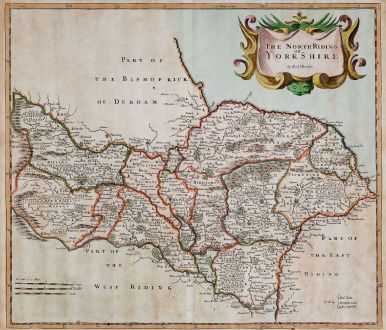
A copy of that map, or one similar used to be on the wall in The Woodman along with other North Riding maps, etc. I have spent many a pint staring at them. ")
I try to picture how the lane between Normanby and Ormesby would have looked like prior to the invasion of our forefathers. Like the majority of the places on that map, you can still see the old cottages in the above mentioned from when they were a village. My wife still says she is walking up to the village when going to Normanby Top.
I noticed there is no South Bank, Grangetown or North Ormesby on the map. Obviously, these places grew with the steel industry.
Thanks for sharing.